Technology

The technology
behind the work

Advanced LiDAR, 3D scanning, real-time GIS, and volume tracking. We invest in current technology because accuracy, safety, and schedule all depend on it.

Technology

What we run in the field

Seven categories of equipment and workflow, maintained and calibrated so results are repeatable from crew to crew and season to season.

Airborne Platforms

Aircraft selected for payload, endurance, and terrain — operated by Transport Canada RPAS-compliant pilots with site-specific flight planning.

LiDAR Scanners

Airborne and terrestrial laser scanning delivering centimetre-level vertical accuracy, vegetation penetration, and dense point coverage.

GNSS Systems

Survey-grade receivers and network RTK for establishing and checking control — the reference every other measurement is traceable to.

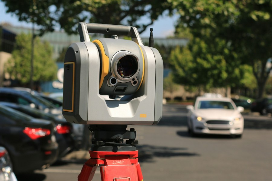
Robotic Total Stations

One-person layout and verification at millimetre tolerance — the workhorse of construction staking and as-built control.

Hydrographic Survey Systems

Single-beam and multibeam echo sounders for river crossings, ponds, and reservoirs — underwater terrain tied to the same control as the survey above the waterline.

GIS & Mapping Platforms

Enterprise GIS, web viewers, and dashboards that put spatial data in front of the people making the decisions.

Data Processing Workflows

Point cloud classification, registration, and QA performed in-house against project control before anything is released.

0Layout tolerance
0Transport Canada RPAS compliant
0Hectares mapped

Quality Assurance

Technology in service of accuracy


Equipment is only half of it. Every deliverable is checked against established control before it leaves the office, and every dataset carries documented lineage.

  • Traceable control — every measurement tied to established survey control
  • Calibration & maintenance — instruments checked on a documented schedule
  • Independent QA — processed data verified before release
  • Documented lineage — metadata on datum, projection, method, and date
  • RPAS compliance — Transport Canada requirements met on every flight
Robotic total station set up on a tripod at a project site

Your Project Next

Have terrain to map or a site to build?

Tell us about your project — we'll recommend the right approach and deliverables.

Request a Quote

Let's talk about your project

Send plans, drawings, or scope documents and we'll turn them around fast.